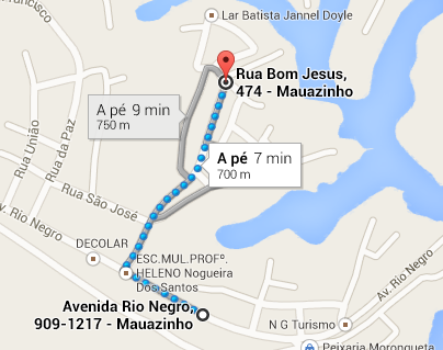
Eu tenho algo mais ou menos assim: uma classe GMapV2Direction.java com o método getDocument, que me fará a consulta à API do Google Maps para direções e me retorna o XML, além de outros métodos úteis que você pode precisar também como distância, tempo, instruções da rota e etc.
public class GMapV2Direction {
    public final static String MODE_DRIVING = "driving";
    public final static String MODE_WALKING = "walking";
    public final static String MODE_TRANSIT = "transit";

    public GMapV2Direction() {
    }

    public Document getDocument(String start, String end, String mode) {
        try {
            String startAddress = URLEncoder.encode(start, "utf-8");
            String endAddress = URLEncoder.encode(end, "utf-8");

            String url = "http://maps.googleapis.com/maps/api/directions/xml?"
                    + "origin=" + startAddress
                    + "&destination=" + endAddress
                    + "&sensor=true&mode=" + mode;

            HttpClient httpClient = new DefaultHttpClient();
            HttpContext localContext = new BasicHttpContext();
            HttpPost httpPost = new HttpPost(url);
            HttpResponse response = httpClient.execute(httpPost, localContext);
            InputStream in = response.getEntity().getContent();
            DocumentBuilder builder = DocumentBuilderFactory.newInstance()
                    .newDocumentBuilder();
            Document doc = builder.parse(in);
            return doc;
        } catch (Exception e) {
            e.printStackTrace();
        }

        return null;
    }

    public boolean statusDirection(Document doc) {
        NodeList nl1 = doc.getElementsByTagName("status");
        Node node1 = nl1.item(0);

        return node1.getTextContent().equalsIgnoreCase("OK");
    }

    public String getDurationText(Document doc) {
        NodeList nl1 = doc.getElementsByTagName("duration");
        Node node1 = nl1.item(0);
        NodeList nl2 = node1.getChildNodes();
        Node node2 = nl2.item(getNodeIndex(nl2, "text"));
        Log.i("DurationText", node2.getTextContent());
        return node2.getTextContent();
    }

    public int getDurationValue(Document doc) {
        NodeList nl1 = doc.getElementsByTagName("duration");
        Node node1 = nl1.item(0);
        NodeList nl2 = node1.getChildNodes();
        Node node2 = nl2.item(getNodeIndex(nl2, "value"));
        Log.i("DurationValue", node2.getTextContent());
        return Integer.parseInt(node2.getTextContent());
    }

    public String getDistanceText(Document doc) {
        NodeList nl1 = doc.getElementsByTagName("distance");
        Node node1 = nl1.item(0);
        NodeList nl2 = node1.getChildNodes();
        Node node2 = nl2.item(getNodeIndex(nl2, "text"));
        Log.i("DistanceText", node2.getTextContent());
        return node2.getTextContent();
    }

    public int getDistanceValue(Document doc) {
        NodeList nl1 = doc.getElementsByTagName("distance");
        Node node1 = nl1.item(0);
        NodeList nl2 = node1.getChildNodes();
        Node node2 = nl2.item(getNodeIndex(nl2, "value"));
        Log.i("DistanceValue", node2.getTextContent());
        return Integer.parseInt(node2.getTextContent());
    }

    public String getStartAddress(Document doc) {
        NodeList nl1 = doc.getElementsByTagName("start_address");
        Node node1 = nl1.item(0);
        Log.i("StartAddress", node1.getTextContent());
        return node1.getTextContent();
    }

    public String getEndAddress(Document doc) {
        NodeList nl1 = doc.getElementsByTagName("end_address");
        Node node1 = nl1.item(0);
        Log.i("StartAddress", node1.getTextContent());
        return node1.getTextContent();
    }

    public ArrayList<LatLng> getDirection(Document doc) {
        NodeList nl1, nl2, nl3;
        ArrayList<LatLng> listGeopoints = new ArrayList<LatLng>();
        nl1 = doc.getElementsByTagName("step");
        if (nl1.getLength() > 0) {
            for (int i = 0; i < nl1.getLength(); i++) {
                Node node1 = nl1.item(i);
                nl2 = node1.getChildNodes();

                Node locationNode = nl2
                        .item(getNodeIndex(nl2, "start_location"));
                nl3 = locationNode.getChildNodes();
                Node latNode = nl3.item(getNodeIndex(nl3, "lat"));
                double lat = Double.parseDouble(latNode.getTextContent());
                Node lngNode = nl3.item(getNodeIndex(nl3, "lng"));
                double lng = Double.parseDouble(lngNode.getTextContent());
                listGeopoints.add(new LatLng(lat, lng));

                locationNode = nl2.item(getNodeIndex(nl2, "polyline"));
                nl3 = locationNode.getChildNodes();
                latNode = nl3.item(getNodeIndex(nl3, "points"));
                ArrayList<LatLng> arr = decodePoly(latNode.getTextContent());
                for (int j = 0; j < arr.size(); j++) {
                    listGeopoints.add(new LatLng(arr.get(j).latitude, arr
                            .get(j).longitude));
                }

                locationNode = nl2.item(getNodeIndex(nl2, "end_location"));
                nl3 = locationNode.getChildNodes();
                latNode = nl3.item(getNodeIndex(nl3, "lat"));
                lat = Double.parseDouble(latNode.getTextContent());
                lngNode = nl3.item(getNodeIndex(nl3, "lng"));
                lng = Double.parseDouble(lngNode.getTextContent());
                listGeopoints.add(new LatLng(lat, lng));
            }
        }

        return listGeopoints;
    }

    public ArrayList<String> getTextDirections(Document doc) {
        NodeList nl1, nl2;
        ArrayList<String> listText = new ArrayList<String>();
        nl1 = doc.getElementsByTagName("step");
        if (nl1.getLength() > 0) {
            for (int i = 0; i < nl1.getLength(); i++) {
                Node node1 = nl1.item(i);
                nl2 = node1.getChildNodes();

                Node locationNode = nl2.item(getNodeIndex(nl2, "html_instructions"));

                listText.add(stripHtml(locationNode.getTextContent()));
            }
        }

        return listText;
    }

    private String stripHtml(String html) {
        return Html.fromHtml(html).toString();
    }

    private int getNodeIndex(NodeList nl, String nodename) {
        for (int i = 0; i < nl.getLength(); i++) {
            if (nl.item(i).getNodeName().equals(nodename))
                return i;
        }
        return -1;
    }

    private ArrayList<LatLng> decodePoly(String encoded) {
        ArrayList<LatLng> poly = new ArrayList<LatLng>();
        int index = 0, len = encoded.length();
        int lat = 0, lng = 0;
        while (index < len) {
            int b, shift = 0, result = 0;
            do {
                b = encoded.charAt(index++) - 63;
                result |= (b & 0x1f) << shift;
                shift += 5;
            } while (b >= 0x20);
            int dlat = ((result & 1) != 0 ? ~(result >> 1) : (result >> 1));
            lat += dlat;
            shift = 0;
            result = 0;
            do {
                b = encoded.charAt(index++) - 63;
                result |= (b & 0x1f) << shift;
                shift += 5;
            } while (b >= 0x20);
            int dlng = ((result & 1) != 0 ? ~(result >> 1) : (result >> 1));
            lng += dlng;

            LatLng position = new LatLng((double) lat / 1E5, (double) lng / 1E5);
            poly.add(position);
        }
        return poly;
    }
}
E aqui a minha Activity, buscando a rota, desenhando ela no mapa e dando foco somente no local onde nos interessa:
public class RouteActivity extends Activity {
    private GoogleMap map;
    private GMapV2Direction directionService;

    @Override
    protected void onCreate(Bundle savedInstanceState) {
        super.onCreate(savedInstanceState);
        setContentView(R.layout.directions);

        map = ((MapFragment) getFragmentManager().findFragmentById(R.id.map))
                .getMap();

        TraceRoute trace = new TraceRoute();
        trace.execute("av afonso pena, 5000, belo horizonte", "rua rio de janeiro, 1278, belo horizonte");
    }

    private class TraceRoute extends AsyncTask<String, Integer, String> {
        private Document doc;

        @Override
        protected String doInBackground(String... params) {
            directionService = new GMapV2Direction();

            if (params.length == 2) {
                String start = params[0];
                String end = params[1];

                doc = directionService.getDocument(start, end,
                        GMapV2Direction.MODE_DRIVING);
            }

            return null;
        }

        @Override
        protected void onPostExecute(String result) {
            if (directionService.statusDirection(doc)) {
                map.clear();

                int minLat = Integer.MAX_VALUE;
                int maxLat = Integer.MIN_VALUE;
                int minLon = Integer.MAX_VALUE;
                int maxLon = Integer.MIN_VALUE;

                int lat;
                int lng;

                ArrayList<LatLng> directionPoint = directionService.getDirection(doc);
                PolylineOptions rectLine = new PolylineOptions().width(7)
                        .color(Color.argb(128, 0, 0, 255));

                for (int i = 0; i < directionPoint.size(); i++) {
                    rectLine.add(directionPoint.get(i));

                    lat = (int) (directionPoint.get(i).latitude * 1E6);
                    lng = (int) (directionPoint.get(i).longitude * 1E6);

                    maxLat = Math.max(lat, maxLat);
                    minLat = Math.min(lat, minLat);
                    maxLon = Math.max(lng, maxLon);
                    minLon = Math.min(lng, minLon);
                }

                map.addPolyline(rectLine);

                double latitudeToGo = (maxLat + minLat) / 1E6 / 2;
                double longitudeToGo = (maxLon + minLon) / 1E6 / 2;

                CameraUpdate center = CameraUpdateFactory.newLatLng(new LatLng(latitudeToGo, longitudeToGo));
                map.moveCamera(center);

                final LatLng southWestLatLon = new LatLng(minLat / 1E6, minLon / 1E6);
                final LatLng northEastLatLon = new LatLng(maxLat / 1E6, maxLon / 1E6);

                map.setOnCameraChangeListener(new GoogleMap.OnCameraChangeListener() {
                    @Override
                    public void onCameraChange(CameraPosition arg0) {
                        map.moveCamera(CameraUpdateFactory.newLatLngBounds(new LatLngBounds(southWestLatLon, northEastLatLon), 70));
                        map.setOnCameraChangeListener(null);
                    }
                });
            }
        }
    }
}
É claro que você pode melhorar, ter uma classe separado da sua Activity e etc, mas isso são os passos básicos. Veja se isso te satisfaz na sua questão e nos diga.
